 a brand of UAV-DEV GmbH
Sand & gravel pits
Remaining volume, extraction progress, slope angles and evidence for authorities, repeatable at fixed intervals.
Hydrographic survey
We survey your waters with the SensorBoat (bathymetry, sounding, hydrographic survey) and deliver fully processed data: depth grid, contour lines, 3D mesh, volume and report. You provide access to the water, we do the rest.
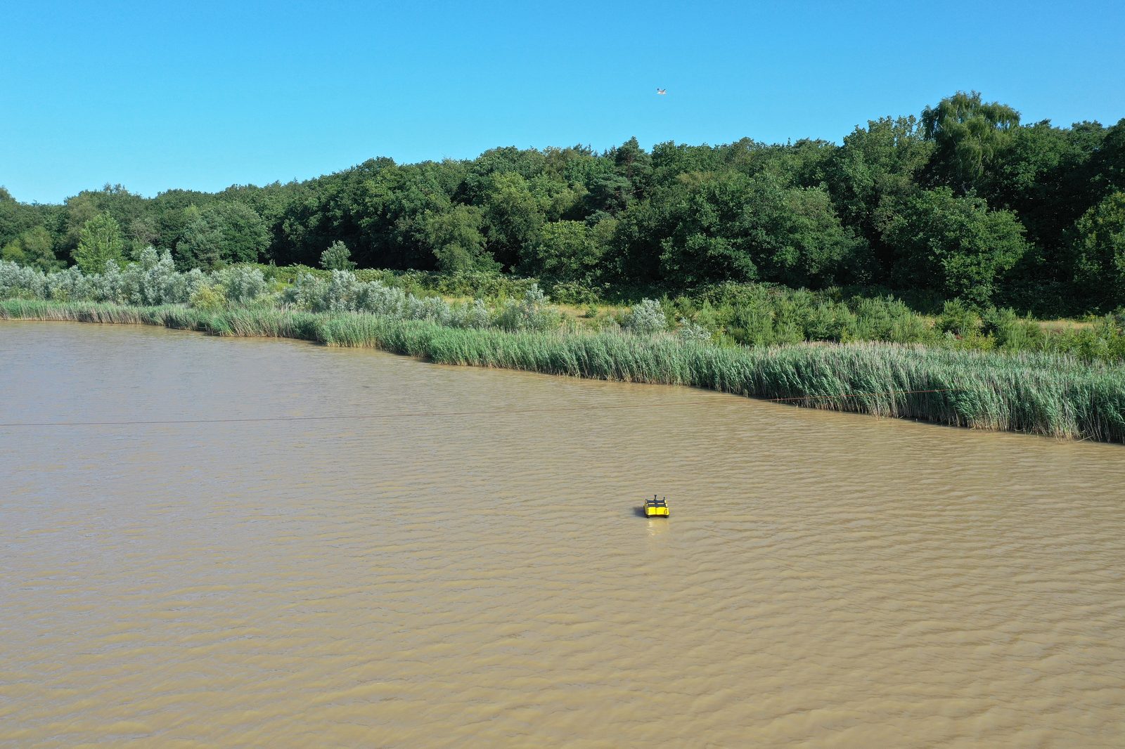 Survey line · RTK georeferenced
Process
You send us location, size and purpose of the survey. We plan survey lines, sensor choice and the survey day and quote a fixed price.
The SensorBoat runs the lines autonomously, RTK GNSS georeferences every depth point. On request a drone flies the orthophoto in parallel.
We clean the raw data, correct sound velocity and water level and compute grid, contours, mesh and volume.
You receive the data in your format plus a short report with key figures and map extracts. We answer follow-up questions directly.
Reference
Survey of the active extraction area of a sand pit with a multibeam echo sounder, combined with a drone orthophoto. Goal: depth model and volume for extraction planning.
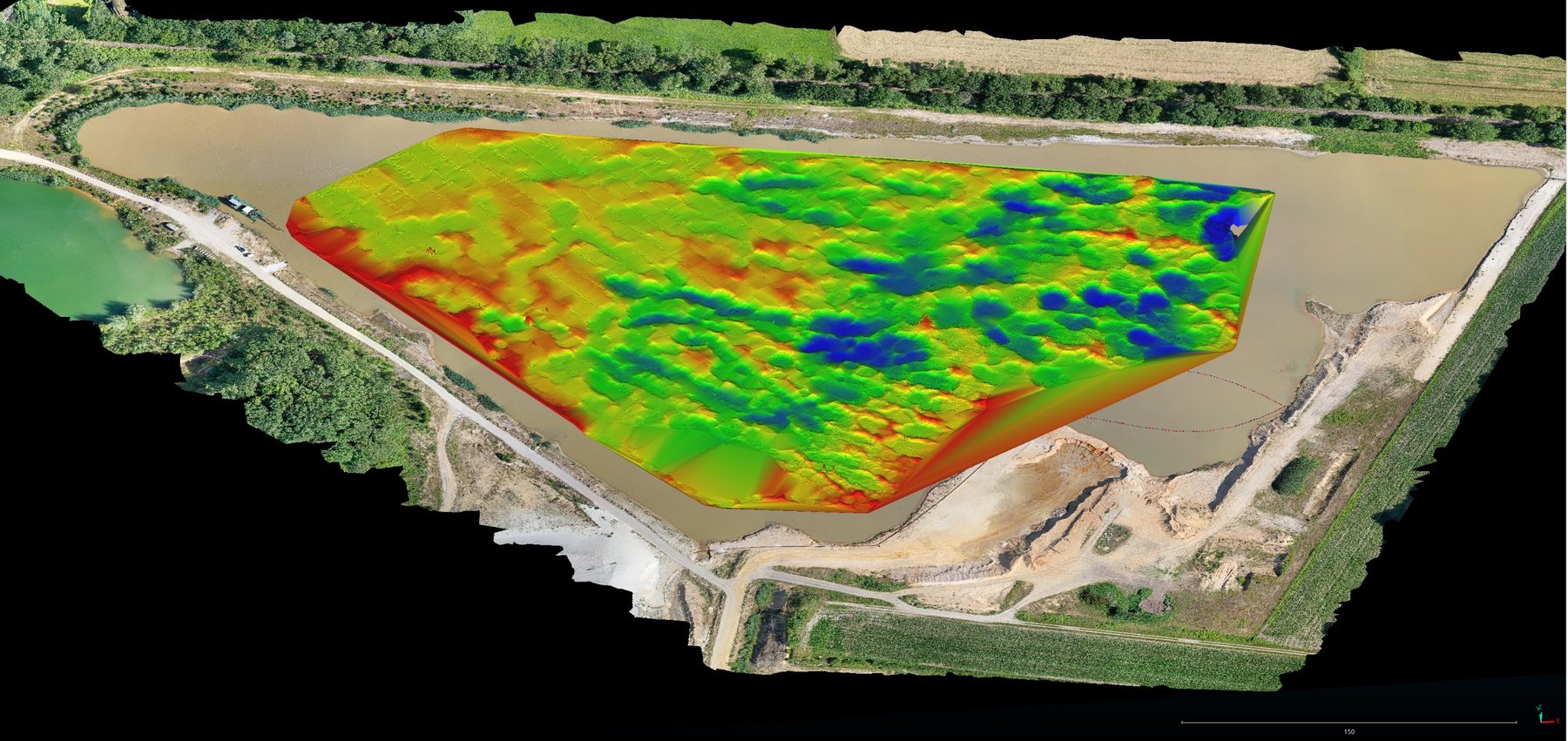
A depth model of the surveyed area as grid and point cloud, contour lines at half-metre intervals, the volume between the current bottom and the target horizon, and the orthophoto as map base. The survey lines are still visible in the relief. Their spacing is chosen so that the multibeam swath covers the area without gaps.
The water depth here was mostly below 6 m, very shallow. Because the swath of a multibeam echo sounder widens with depth, shallow waters need closely spaced survey lines. The deeper the lake, the wider the line spacing and the faster the area is surveyed.
Acquired with SonarView, processed in ReefMaster and QGIS. Other formats and evaluations on request.
Deliverables
Applications
Remaining volume, extraction progress, slope angles and evidence for authorities, repeatable at fixed intervals.
Target depth checks, sedimentation in front of quay walls and in harbour entrances, sounding before and after dredging.
Silting, loss of storage volume and sludge levels, also in basins without a boat ramp. The SensorBoat is carried by two people.
Depth maps for bathing and fishing lakes, pond systems and nature reserves: silting, sediment thickness and baseline survey before restoration or desludging.
Sludge distribution in secondary clarifiers and lagoons, without staff on the water and without interrupting operations.
Side-scan imagery for wrecks, lost objects, pipelines and structure foundations.
FAQ
The price depends on water area, water depth, required resolution and deliverables. After your enquiry with location and approximate area you receive a fixed-price quote within a few days. For small sand pits and basins one morning of surveying is often enough.
Standing and slow-flowing waters: sand and gravel pits under wet extraction, dredging lakes, harbours and berths, retention basins, reservoirs, treatment plant basins, ponds and lakes. Waters with strong currents are not suitable. The SensorBoat is carried by two people and needs no slipway.
The position of every depth point is determined by RTK GNSS at centimetre level. Depth is measured by a multibeam or single-beam echo sounder. Sound velocity and water level are corrected during processing. The result is a bathymetry suitable for volume calculation, sounding and extraction planning.
Point cloud (XYZ, CSV, LAS), depth grid as GeoTIFF, contour lines as DXF or shapefile, a 3D mesh, volume calculation and a short report as PDF. On request additionally a drone orthophoto of the shoreline and a side-scan mosaic.
The SensorBoat runs about 12 hours per battery charge and covers a sand pit of about ten hectares with a multibeam echo sounder in one morning. The deeper the water, the wider the swath and the faster the area is covered.
Send us location, approximate area and purpose. You will receive a fixed-price quote within a few days.